
What is the name and location of the wildfire?
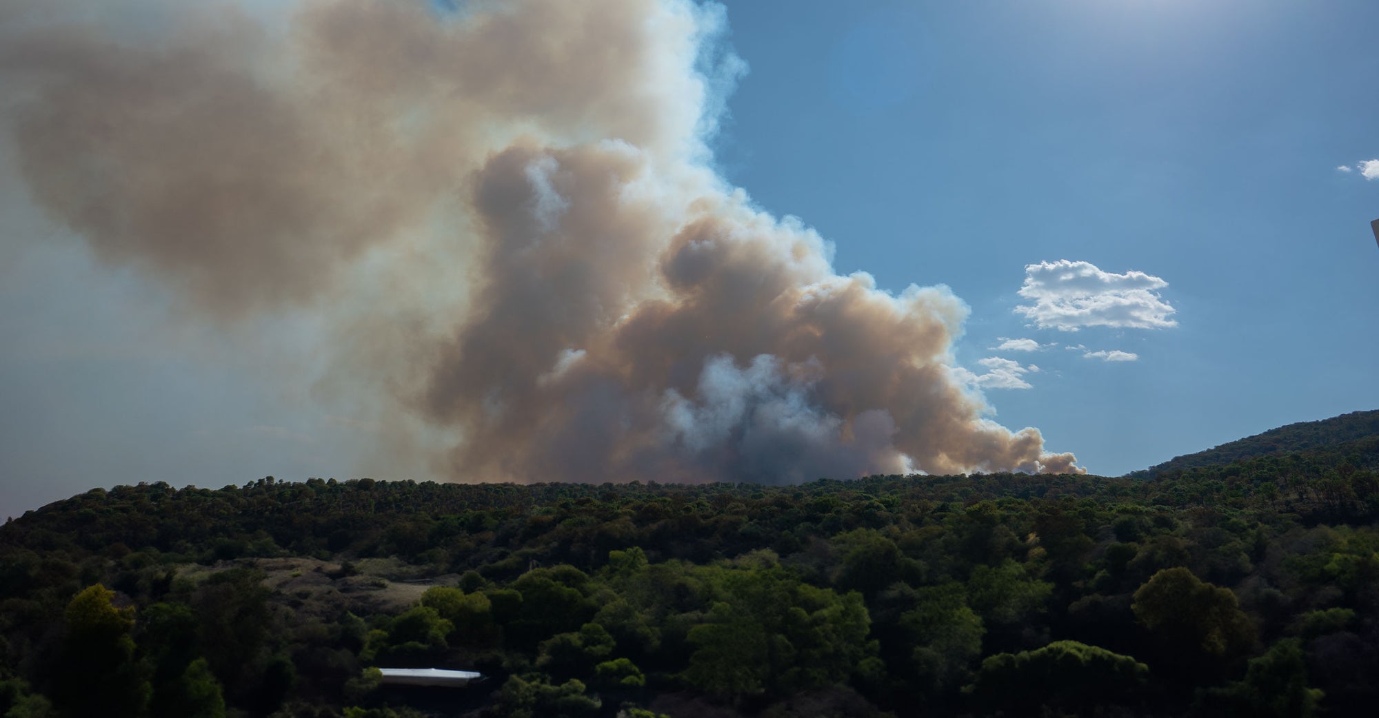
On March 28, 2024, there are 116 active wildfires across Mexico, spanning 6,000 hectares (14,826 acres) and 20 states (1)(2). At least four people have died in the blazes.
The wildfires range from the central mountainous region of Veracruz state to México state surrounding the capital city of Mexico City (3)(4). At least 20 of the fires are located in México state.
Which cities or areas are affected by the wildfire?
The fires are affecting air quality across central and southern Mexico, including:
- Mexico City
- Nogales, Veracruz
- Oaxaca
- Puebla
Particularly affected are various municipalities in Veracruz state, especially those in the central mountainous region. Cities and towns such as Minatitlán, Orizaba, and neighboring communities are directly threatened by the wildfires.
What is the current containment status of the wildfire?
As of early Wednesday, the containment status varies across the nation. In Veracruz, state authorities have reported that the wildfires are between 50% and 90% controlled. However, the specific containment percentage for each affected area may vary.
There are currently over 5,700 personnel combating the fires nationwide, drawn from the National Guard (GN), Defense Ministry (Sedena), state Environment Ministry (Sedema) and municipal brigades.
Protect yourself from wildfire smoke
See how a wildfire smoke air purifier can help clean your air.
How can I protect myself from wildfire smoke?
Always plan ahead to protect yourself from wildfire smoke.
- Get a free air quality app for real-time air quality alerts and forecasts.
- Shut doors and windows and set the HVAC to recirculate mode.
- Run a high-performance air purifier to filter wildfire smoke.
- Contribute to your community’s outdoor air quality.
- Stay indoors; if you do need to go outdoors, wear a KN95/FFP2 mask.
The number one air cleaning solution for your home.
Lorem ipsum Donec ipsum consectetur metus a conubia velit lacinia viverra consectetur vehicula Donec tincidunt lorem.
TALK TO AN EXPERTArticle Resources
Article Resources